Satellite Images Can Harm the Poorest Citizens

theatlantic

In Ho Chi Minh City, computer analysis of orbital images overlooks some urban communities. To represent them, cities will have to put boots on the ground.

An aerial view of the outskirts of Ho Chi Minh City
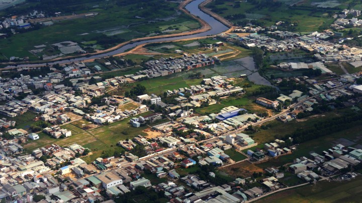
An aerial view of the outskirts of Ho Chi Minh CityRAKSYBH / SHUTTERSTOCK

Mapping a city’s buildings might seem like a simple task, one that could be easily automated by training a computer to read satellite photos. Because buildings are physically obvious facts out in the open that do not move around, they can be recorded by the satellites circling our planet. Computers can then “read” these satellite photographs, which are pixelated images like everyday photographs except that they carry more information about the light waves being reflected from various surfaces. That information can help determine the kind of building material and even plant species that appears in an image. Other patterns match up with predictable objects, like the straight lines of roads or the bends of rivers.

It turns out to be more complicated than that. When three different research groups (including my own at the University of Southern California) processed almost the same images of Ho Chi Minh City’s rapid urbanization during the 2000s, we produced different results. All three groups agreed on the location of the city center, but mine mapped the city’s periphery differently. That’s the place where most megacities in the global South exhibit their most dramatic physical growth. In particular, we identified more of the informal, self-built housing in the swampier southern area of the city.
Tiếp tục đọc “Satellite Images Can Harm the Poorest Citizens”

Thủy điện Yên Bái tầng tầng lớp lớp, ‘sang tên’ cho nhau loằng ngoằng

Nông Nghiệp VN Cập nhật: 14:25, Thứ 3, 07/08/2018

Làm nhà máy thủy điện đầu tư lớn nhưng lãi cũng rất lớn nên người ta mới đổ xô đi làm thủy điện. Một chủ dự án thủy điện không giấu diếm: Sau khi nhà máy thủy điện hoàn thành, nước cứ chảy qua tuốc-bin, tức là tiền đã chui vào túi tôi…

Trước sự tàn phá của các nhà máy thủy điện, khiến nhiều cử tri phản ánh lên các đoàn đại biểu Quốc hội phản đối Bộ Công Thương và các tỉnh cấp phép xây dựng thủy điện tràn lan, phá vỡ môi sinh môi trường, gây lũ lụt và hạn hán… Ngày 23/11/2012 Quốc hội ban hành Nghị quyết 40/2012/QH13 yêu cầu Bộ Công Thương rà soát tổng thể quy hoạch thủy điện. Sau khi rà soát tỉnh Yên Bái đã loại bỏ 41 dự án thủy điện… Tiếp tục đọc “Thủy điện Yên Bái tầng tầng lớp lớp, ‘sang tên’ cho nhau loằng ngoằng”

Thảm họa phát triển sông Mekong đang diễn ra thế nào?

 26/04/2018 

Chiến lược lớn mà Trung Quốc dành cho sông Mekong sẽ tác động ra sao tới con sông và các nước hạ nguồn? Dòng sông Mekong từ lâu đã mang một màu sắc kỳ bí của những cuộc phiêu lưu, những chuyên gia về hoang dã, và các nhà khoa học luôn bị mê hoặc bởi dòng chảy và những thác nước của dòng sông này, cùng với những chú cá heo nước ngọt đang có nguy cơ tuyệt chủng, cá đuối khổng lồ và những con cá sấu Siamese. Sự đa dạng sinh học của dòng sông này chỉ đứng sau sông Amazon. Tiếp tục đọc “Thảm họa phát triển sông Mekong đang diễn ra thế nào?”