Phần này bàn về các tục lệ tang chế truyền thống ở Việt Nam từ thời LM de Rhodes và các giáo sĩ Tây phương sang Á Đông truyền đạo. Đây là lần đầu tiên cách dùng này hiện diện trong tiếng Việt qua dạng con chữ La Tinh/Bồ (chữ quốc ngữ), điều này cho ta dữ kiện để xem lại một số cách đọc chính xác hơn cùng với chữ Nôm, cũng như một số tục lệ không còn hiện diện nữa.
“As Togo’s foreign minister Robert Dussey told the assembly, “A fair map does not change the geography of the world, it changes how we see it.”
Why the UN Wants a Different World Map
Key Takeaways
On Sept. 4, 2026, the UN General Assembly adopted the “Correct the Map” resolution by a 164-1 vote, endorsing the Equal Earth projection.
The non-binding resolution encourages governments, schools, media, international organizations, and technology platforms to use equal-area maps when comparing the sizes of continents.
Unlike Mercator, Equal Earth preserves the true relative size of landmasses, dramatically changing how places such as Greenland, Canada, and Africa appear beside one another.
For more than four centuries, the Mercator projection has shaped one of the world’s most familiar views of the planet.
The icon map was designed to make navigation on the Earth’s oceans easier, but it came with a cost: the farther a place lies from the equator, the more dramatically its size is exaggerated.
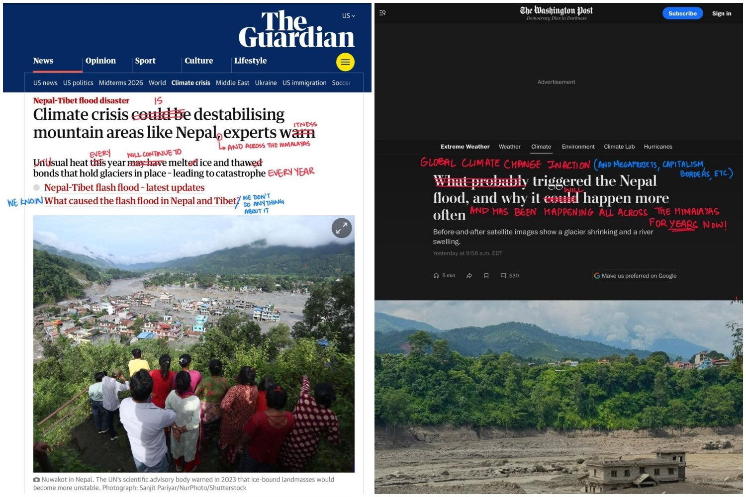
In coverage of the catastrophic Bhote Kosi flood, many mainstream western news outlets have failed to confidently state the significance of the climate crisis, or to cite the human-made structures that produce it.
Headlines from The Guardian (left) and The Washington Post (right) covering the Nepal-Tibet flood, marked in red by designers and former Harvard classmates Fatima Hamdani and Bhavya Jain. Photos: FATIMA HAMDANI AND BHAVYA JAIN / INSTAGRAM In coverage of the catastrophic Bhote Kosi flood, many mainstream western news outlets have failed to confidently state the significance of the climate crisis, or to cite the human-made structures that produce it.
Two days after catastrophic flooding began, designers and former Harvard classmates Bhavya Jain and Fatima Hamdani posted a carousel of headlines plucked from mainstream western news outlets on their Instagram.
By taking a red pen to each headline in the style of Alexandra Bell’s Counternarratives series, Hamdani and Jain called attention to journalists’ noncommittal tone, which served to obfuscate the connection between the Bhote Kosi flood and climate change.
The post went viral, with more than 32,000 likes at press time. In an accompanying article on Hamdani and Jain’s shared Substack, Climate Without Borders, they write that news agencies “quote survivors’ shock and panic” but not “experts’ warning from decades past on the climate crisis.”
“Ambiguity is always dangerous because it shies away from responsibility,” Jain tells me. “It is the work of the media to bring attention to evidence that has been ignored or years now.”
DENIALISM
While Hamdani and Jain call out mainstream western media for failing to establish a strong causal link between the flood, glacial collapse, and the warming atmosphere, some argue that western journalists are using climate change as “an explanation without evidence.”
One phone call saved thousands of lives after river gauges were swept away on 26 August
Devesh Belbase·Aug 31, 2026·NEWS
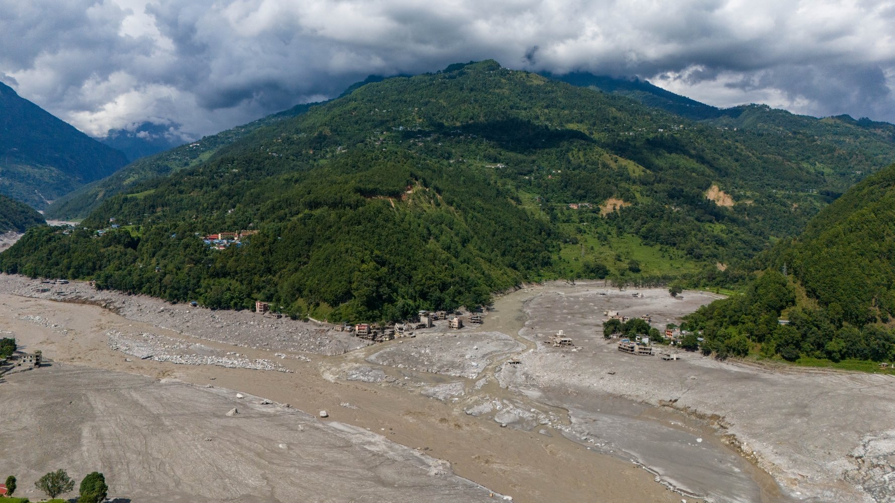
Photo: SUMAN NEPALI
Going by the numbers Nepal uses to define danger, the flood of 26 August was unremarkable.
At 8:40am on 26 August, the automatic gauge on the Bhote Kosi on Nepal’s border with China recorded the water level at 1.62m. It was low, and falling.
That was the last reading of the Rasuwagadi station. The wall of water coming down the Lhende Khola destroyed the equipment before the next reading was due. The gauge at Syaphrubesi 15km downstream died when the water level reached 3.8m. Betrawati was knocked out at 3.55m. These were all below the prescribed Amber warning thresholds.
It was 4pm by the time the flood peaked at 6.57m in Devghat, 170km downstream on the Narayani River. That was the highest point measured during this flood event, but still below the Amber warning level of 7.3m (see charts).
Devghat is the last gauge on the river, and it stayed green throughout the flood of 26 August.
But upstream, hundreds of people had already been swept away the fury of the mudflow. Between Rasuwa to Chitwan, 22 concrete bridges were washed away, a dozen hydropower plants were damaged or destroyed, as were four of the flood monitoring stations built to protect them.